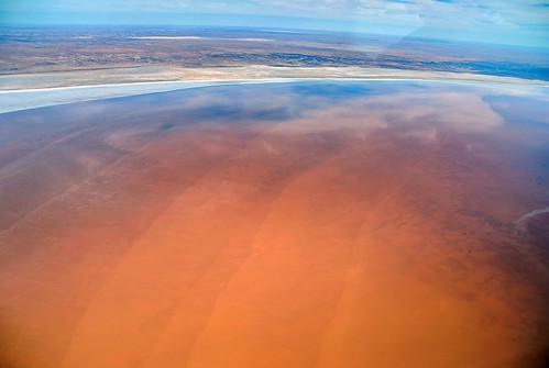
Lake Eyre – Australia
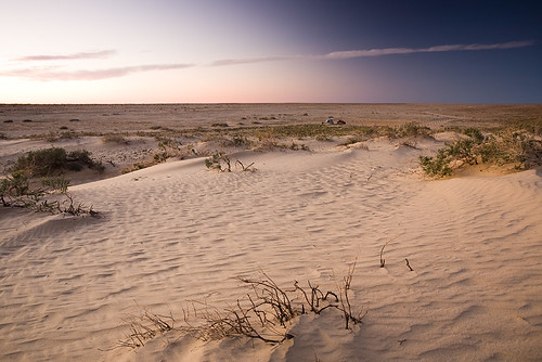
 Lake Eyre is the lowest point in Australia, at approximately 15 m (49 ft) (AHD) below sea level, and, on the rare occasions that it fills, it is the largest lake in Australia. It is the focal point of the vast Lake Eyre Basin and is found some 700 km (435 mi) north of Adelaide.
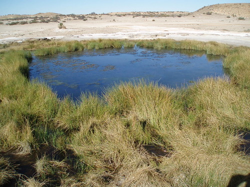
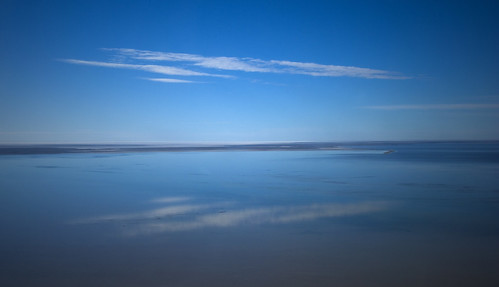
During the rainy season the rivers from the northeast (in outback Queensland) flow towards the lake through the Channel Country. The amount of water from the monsoon determines whether water will reach the lake and if it does, how deep the lake will get. In strong La Niña years the lake can fill. Since 1885 this has occurred in 1886–1887, 1889–1890, 1916–1917, 1950, 1955, 1974–1976 , with the highest flood of 6 m (20 ft) in 1974. Local rain can also fill Lake Eyre to 3–4 m (10–13 ft) as occurred in 1984 and 1989. Wave built shingle terraces on the shore suggest that during the Medieval Warm Period and centuries immediately prior Lake Eyre possibly held permanent water at levels above those of 1974. Torrential rain in January 2007 took about six weeks to reach the lake but put only a small amount of water into it.
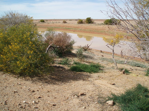
When recently flooded the lake is almost fresh and native fresh water fish, including bony bream (Nematolosa erebi), the Lake Eyre Basin sub-species of golden perch (Macquaria ambigua) and various small hardyhead species (Craterocephalus spp.) can survive in it. The salinity increases as the 450 mm (18 in) salt crust dissolves over a period of six months resulting in a massive fish kill. When over 4 m (13 ft) deep the lake is no more salty than the sea and salinity increases as the water evaporates, with saturation occurring at about a 500 mm (20 in) depth. The Lake takes on a “pink” hue when saturated due to the presence of beta-Carotene pigment caused by the algae Dunaliella salina.
Typically a 1.5 m (5 ft) flood occurs every three years, a 4 m (13 ft) flood every decade, and a fill or near fill four times a century. The water in the lake soon evaporates with a minor and medium flood drying by the end of the following summer.
The 2009 Lake Eyre flood peaked at 1.5 m (5 ft) deep in late May which is a quarter of its maximum recorded depth of 6 m (20 ft). 9 km3 (2 cu mi) of water crossed the Queensland–South Australian border with most of it coming from massive floods in the Georgina River. However the greater proportion soaked into the desert or evaporated en route to the lake leaving less than 1 km3 (0.24 cu mi) in the lake which covered an area of 800 km2 (309 sq mi) or 12% of the lake. As the flood did not start filling the lake’s deepest point (Belt Bay) until late March little bird life appeared preferring instead to nest in the upper reaches of the Lake Eyre Basin, north of Birdsville, where large lakes appeared in January as a result of monsoonal rain.
credited to wikipedia and flickr users: goody62, simonwaterhouse, gsketch2000, c_and_g, mitshellh53, nic_pepsi